SWAN2: Development Sites
- The Neighbourhood Plan allocates the following sites within the Settlement Boundary, as shown on the Policies Map, for a change of use to residential and/or mixed uses. In applying National Decision-Making Policy DP3, development proposals should respond to their context and create well-designed places by adopting the following key principles:
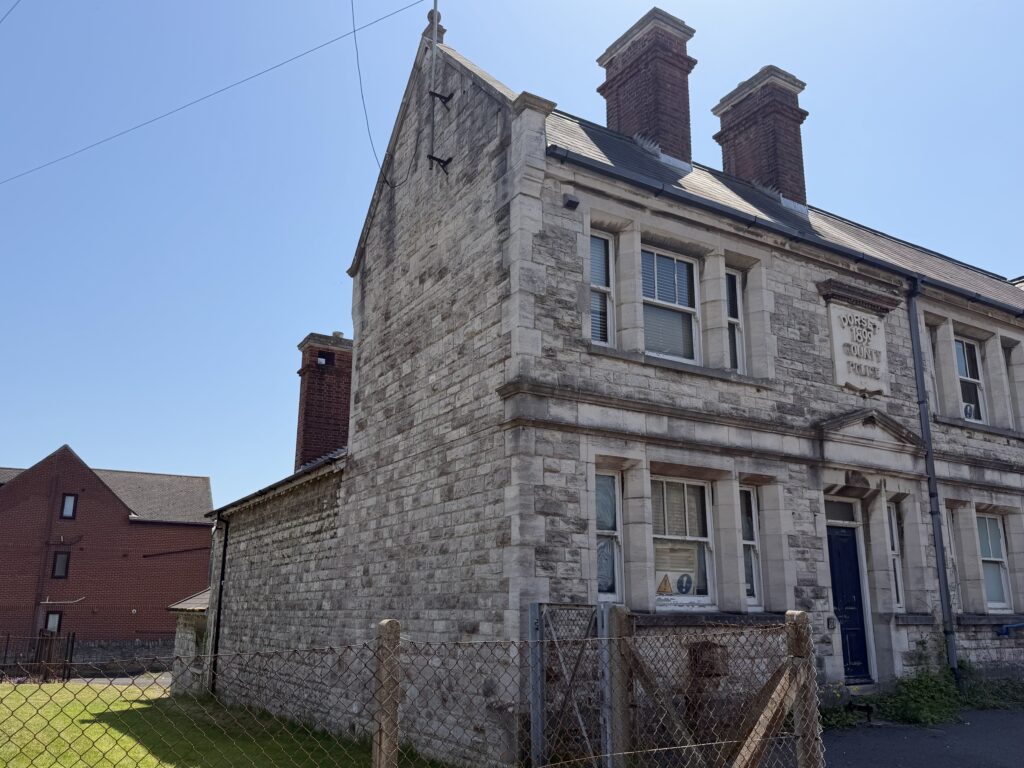
The Former Police Station, Argyle Road (Site Code 03)
- The existing building must be retained and converted into new homes with the redevelopment of the remainder of the site to deliver a scheme of approx. 12 homes. Proposals should actively consider the inclusion of community-led housing as part of any scheme;
- The scheme design must address the risk of flooding from various sources on parts of the site;
- The built form of the redeveloped part of the site must be of a perimeter block type facing onto Kings Road West and Argyle Road of 2.5 storeys in height and should include prominent gabled dormers above full height and canted bay windows;
- The corner plot at the road junction should respond to its prominence in views eastwards along Kings Road West by using some architectural device that adds interest and legibility to the streetscene to complement other corner plots in the vicinity;
- The scheme design should seek to save and reuse the distinctive concrete moulded name plate on the existing building front elevation as a remainder of the site’s past use;
- The building line must be no more than 3m behind the back of pavement on Kings Road West or 2m on Argyle Road with the boundary defined by a low brick and/or stone wall; and
- Car parking must be provided to the rear and is accessed from Argyle Road via an archway in the building frontage.
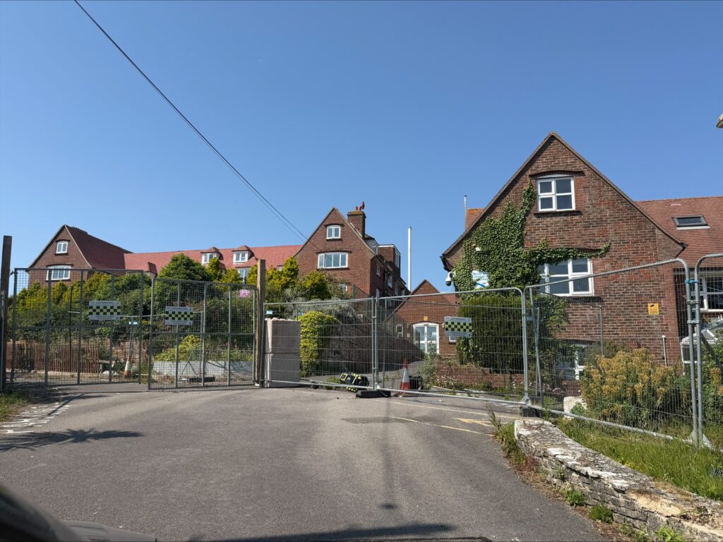
The Former Harrow House School, off Walrond Road (Site Code 05)
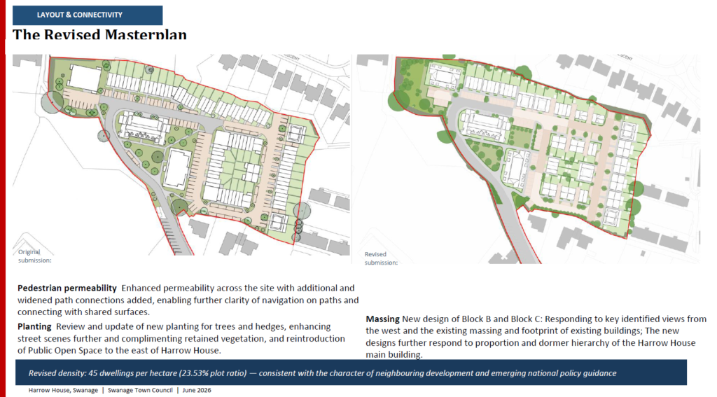
- The scheme comprises the retention and conversion of the main school building for flatted accommodation and the clearance and redevelopment of the remainder of the site to deliver a scheme of approx. 45 homes comprising a mix of houses and apartments;
- In addition to the retained main school building, scheme layout should comprise two zones of maximum building heights of three storeys on the land adjoining the existing school building to its east, and a mix of two and three storeys on the remainder of the developable area;
- The scheme layout must not position new buildings any closer to the listed Cauldron Barn and Farmhouse than the existing buildings and the landscape scheme should bolster the screening between the two sites;
- The building forms should comprise a variety of pitched and hipped roofs to create a roofscape that blends into the surrounding suburban character of the Northbrook Road area to its south and east.
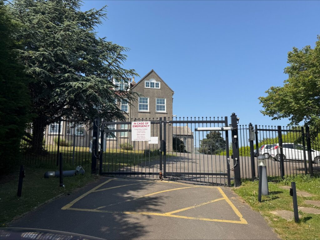
The Former Purbeck View School, off Northbrook Road (Site Code 06)
- The site may either be cleared and redeveloped, or the existing building may be retained and converted, or some combination of the two, to deliver a scheme of approx. 50 homes;
- Irrespective of which development option is proposed, the chapel building must be retained and re-used for community purposes;
- If redeveloped the building heights must be no higher than the existing buildings on the site;
- The building forms should comprise a variety of pitched and hipped roofs to create a roofscape that blends into the surrounding suburban character of the Northbrook Road area to its south and east;
- The site should be accessed by vehicles from the existing northern access on to Northbrook Road with the existing southern access at the junction of Northbrook Road and Walrond Road used only for pedestrian and cycle access; and
- The landscape scheme must retain the mature tree and hedge boundary to Northbrook Road.
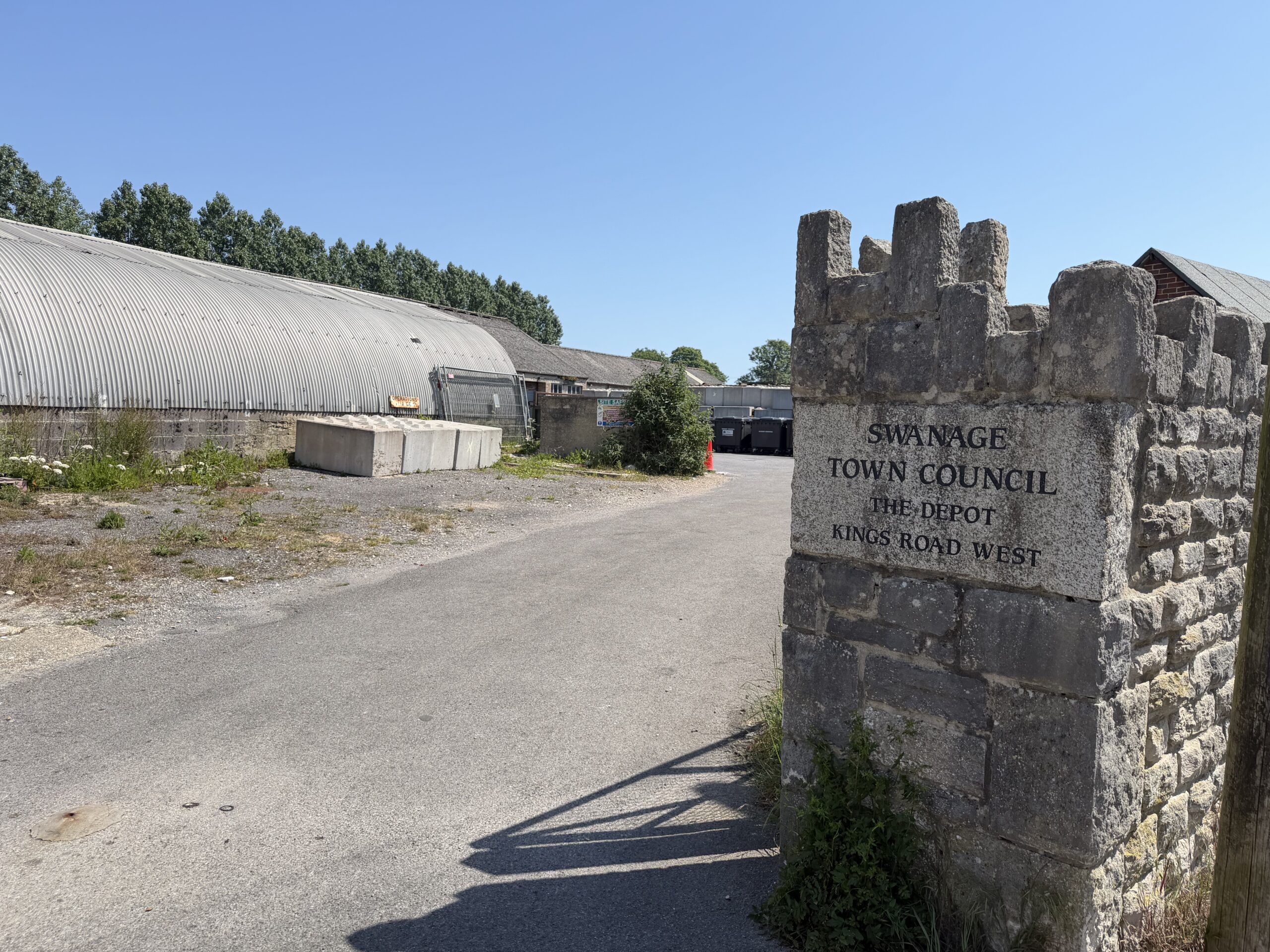
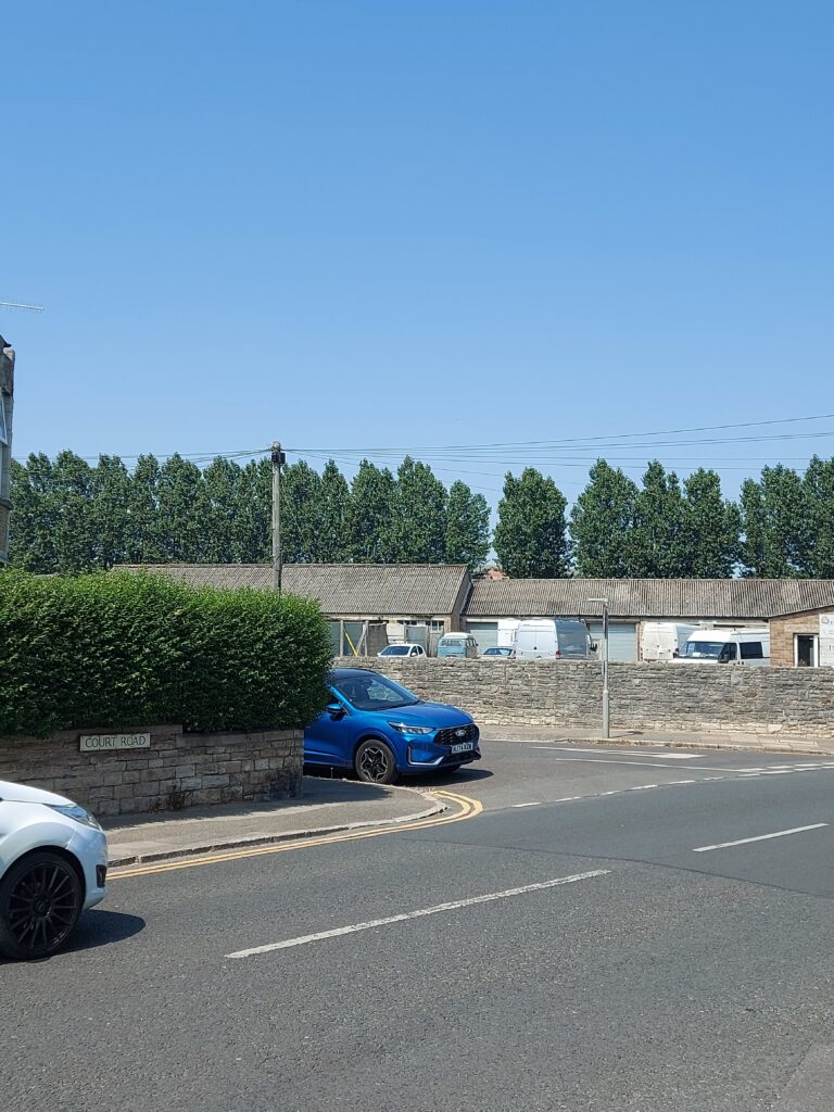
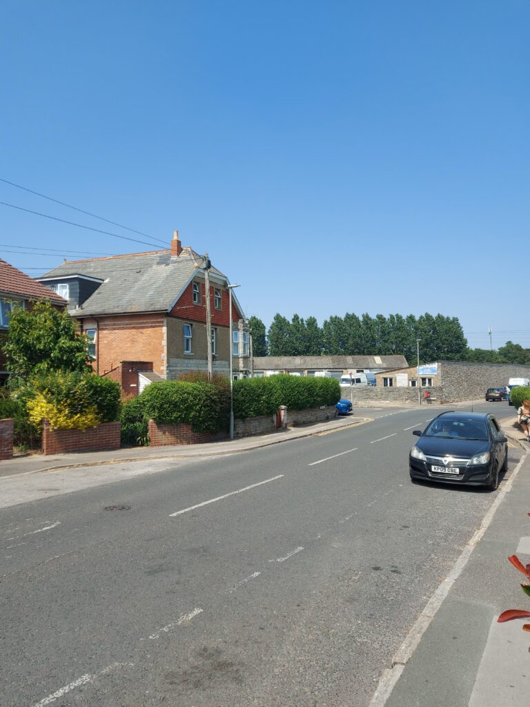
Land at Kings Court Business Centre & Depot, Kings Road West (Site Code 10)
Proposals for redevelopment of the site to deliver a mixed-use scheme will be permitted where:
- Provision is made for around 20 homes and commercial/business units in Use Classes E(d)(f) and (g) only, unless it is demonstrated that a residential only scheme is the only viable option;
- It is demonstrated that the inclusion of community led housing as part of residential provision has been fully investigated;
- The scheme layout and design must reflect the relative vulnerability of different uses to the risk of flooding on part of the site;
- The arrangement of residential and commercial and business units, and the nature of the operation of the commercial and business units, must mitigate any harm to residential amenity arising from noise pollution;
- The arrangement and height of the buildings should allow for a view of the Purbeck Hills from Court Road;
- The built form should comprise a perimeter block type facing onto Kings Road West and Court Road of 2.5 storeys in height (including prominent gabled dormers above full height, bay windows) with a courtyard arrangement of units to the rear;
- The corner plot at the road junction must respond to its prominence in views eastwards and westwards along Kings Road West and northwards along Court Road by using some architectural feature that adds interest and legibility to the street scene to complement other corner plots in the vicinity;
- The building line must be no more than 2m behind the back of pavement on Kings Road West or 1m on Court Road with any boundaries defined by a low stone wall; and
- Car parking must be provided to the rear and should be accessed from either Kings Road West or Court Road via an archway in the building frontage.
Land off Prospect Way (Site Code 11)
- The Neighbourhood Plan allocates Land North of Prospect Way (Site Code 11) adjoining the Settlement Boundary, as shown on the Policies Map, for a major residential scheme and a Suitable Alternative Natural Greenspace (SANG). In applying National Decision-Making Policy DP3, development proposals should respond to their context and create well-designed places by adopting the following key principles:
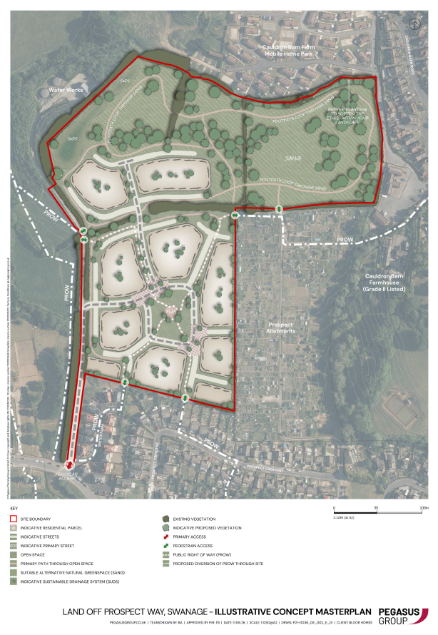
- The residential scheme on the developable area shown on the Concept Plan in Fig 4 below must comprise an area for approx. 100 open market homes and an area for a community-led development of approx. 70 affordable homes, but need not provide for any self-build or custom build homes;
- The remainder of the site at Prospect Smallholding must accommodate a new SANG of a specification to be agreed;
- The vehicular access to the developable area and SANG must be from Prospect Way only, with additional pedestrian access from the existing public rights of way (Path SE3/23 from Cauldron Barn Road to Smiths Farm and Path SE3/24 from Prospect Crescent to Path SE3/2) as they enter the site;
- The existing public rights of way that cross the site (Paths SE3/23 and SE3/24) must be retained but may be redirected within the site to suit the proposed arrangement of amenity space and green infrastructure;
- The layout and landscape scheme should provide for an effective transition from the developable area to the National Landscape countryside to the west; and
- The building forms should be no more than two storey houses of a variety of pitched and hipped roofs to create a roofscape that blends into the surrounding suburban character of Prospect Crescent and Smiths Farm to its south and of the wider suburban area to its east.
This site does not include the Prospect Allotments.
Land off Ulwell Road (Site Code 13)
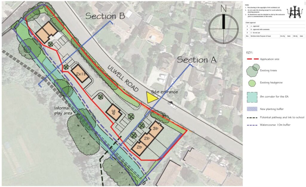
- The Neighbourhood Plan allocates Land off Ulwell Road (Site Code 13) adjoining the Settlement Boundary, as shown on the Policies Map, for a community-led development of affordable homes. In applying National Decision-Making Policy DP3, development proposals should respond to their context and create well-designed places by adopting the following key design requirements:
- The residential scheme should comprise approx. 10 homes, which may include a minimum number of open market homes that can be demonstrated to be necessary for scheme viability, provided the proportion of those homes is no greater than 25%;
- The scheme layout must address the risk of flooding on the perimeters of the site;
- The loss of vegetation on the site frontage should be compensated for by bolstering the planting around the other site edges and private garden spaces as part of the landscape scheme; and
- The buildings should be no more than two storeys in height.
- This policy allocates land for development to deliver the spatial plan of Policy SWAN1 and comprises three parts. Its provisions define how National Decision-Making Policy DP3 on establishing key principles for well-designed places should be implemented on the sites. The principles are drawn from the site assessment work and informed by the SEA process, as summarised in Appendix A.
- In accordance with National Decision-Making Policy PM12 on developer contributions, early engagement work has been undertaken with most of the land interests indicates that the development principles can be met without undermining the viability of future proposals, per provisions of its Policy DM5 on development viability.
- Clause A allocates four sites in the Settlement Boundary to support their change of use from former community and commercial to primarily residential uses of approx. 127 homes. Clause B allocates land for a major residential scheme of 170 homes and a SANG adjoining the Settlement Boundary on the basis that the proposal for a significant community-led affordable housing project demonstrates the exceptional circumstances for development of this scale in the National Landscape. Clause C allocates another, much smaller site, for a community-led affordable housing scheme of 10 homes adjoining the Settlement Boundary.
Policy Map
ArcGIS map © Esri. Contains OS data © Crown Copyright and database right 2026 OS AC0000812260. Contains public sector information licensed under the Open Government Licence v3.0. Terms and Conditions Apply. Looking for more map layers? Explore the full Policy Map